2026 Winter Calendar
Below is our current Winter Calendar. Further event details are available at the Athletics Wellington site - HERE
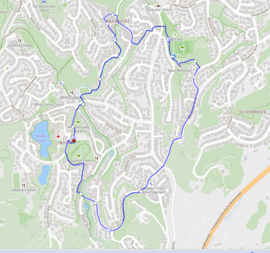
Training Routes
We have put together some local runs below but you can also build your own: How far did I run? - Create running maps with On The Go Map
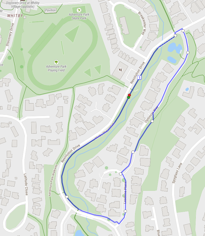
1km - start at the path by ‘the eels’ leading to Adventure Park, a single loop around the shared pathway via Leadline Place and Optimist Way.
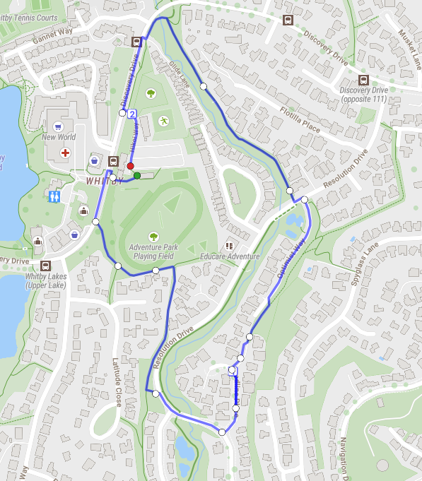
2km - start at Adventure Park pavilion and go up Discovery Drive, follow the pathway back down to Adventure Park then onto Resolution Drive, before going along Leadline Place and Optimist Way. Carry on down the shared pathway to Whitby Collegiate, then back up Discovery Drive to the pavilion.
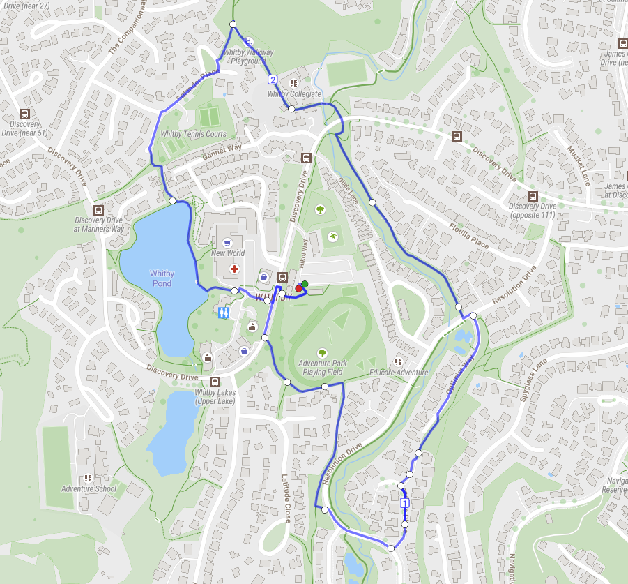
3km - building on the 2km loop, continue past Whitby Collegiate to the playground, and take the walkway up to Solander Place. Continue past the Tennis Club, up the steep pathway to take you back along the lake and cross the road to the pavilion.
5km - building on the 3km run, continue up Navigation Drive past Whitby Link Road. Take Samwell Drive down to Endeavour Park. Follow the path past the playground, through the underpass. Make your way down the hill to Brookside, then up the shared path past Whitby Collegiate and back to the pavilion.
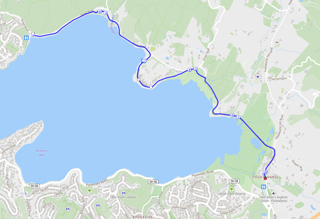
10km - start at Pāuatahanui Village, follow the coastal walkway until you reach the Jetski Club carpark. Turn around and follow the path back to the start.